Sircilla, which means “centre of wealth” in the word “Sirishala“, is a town in the Indian state of Telangana and serves as the district headquarters of Rajanna Sircilla district. Located on the banks of river Maneru, Rajanna Sirisilla district was formed on 11 October 2016 after being split from the old Karimnagar district.
Named after the revered deity “Rajanna” (Sri Raja Rajeshwara Swamy) of Vemulawada temple, this district represents the perfect confluence of spirituality, industry, and natural beauty.
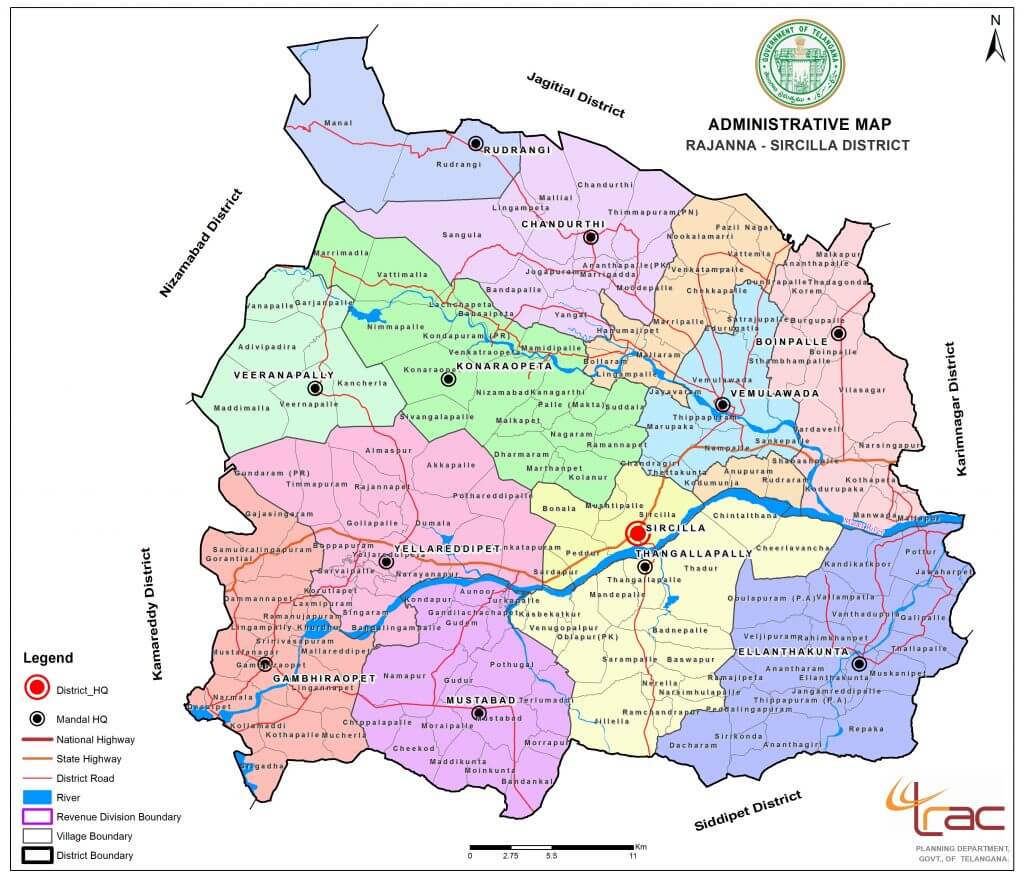
The district, surrounded by Karimnagar, Kamareddy and Siddipet districts, comprises of one revenue division and 13 mandals. Known for its rich textile heritage, pilgrimage sites, and unique cultural traditions, this district is a vibrant blend of culture, industry and heritage.
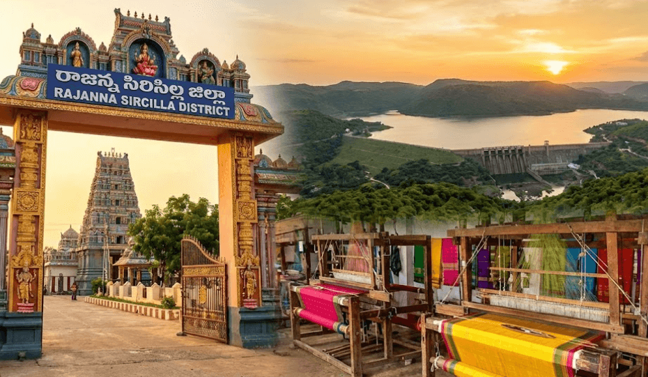
The district is a unique blend of industrial prowess and deep-rooted spirituality. While Sircilla town is world-famous for its weaving and power looms, Vemulawada serves as a major pilgrimage destination for millions.
Established in 1952, Sircilla Municipality has been upgraded to a first-grade municipality (according to G.O.No 50, dated 08-03-2018) and currently encompasses 34 election wards. The municipality’s jurisdiction spans an area of 55.47 square kilometers.
సిరిసిల్ల అనే పేరు “సిరిశాల” అనే పదం నుండి ఉద్భవించింది, అంటే “సంపద యొక్క కేంద్రం”. ఈ పట్టణం భారతదేశంలోని తెలంగాణ రాష్ట్రంలోని రాజన్న సిరిసిల్ల జిల్లాకు జిల్లా కేంద్రంగా పనిచేస్తుంది. రాజన్న సిరిసిల్ల జిల్లా మానేరు నది ఒడ్డున ఉంది. పవర్ లూమ్లు, టెక్స్టైల్ ప్రాసెసింగ్ మరియు డైయింగ్ యూనిట్లు ఎక్కువగా ఉండటం వల్ల సిరిసిల్ల పట్టణం ను “వస్త్ర పట్టణం”గా కూడా పిలుస్తారు.
ఇది పాత కరీంనగర్ జిల్లా నుండి విడిపోయి రాజన్న సిరిసిల్ల జిల్లా అక్టోబర్ 11, 2016న ఏర్పాటైంది. ఈ జిల్లా కరీంనగర్, కామారెడ్డి మరియు సిద్దిపేట జిల్లాలతో చుట్టుముట్టబడి ఒక రెవెన్యూ డివిజన్ మరియు 13 మండలాలను కలిగి ఉంది.
Table of Contents
Know about Rajanna Sircilla In Telugu
సిరిసిల్ల అనే పేరు “సిరిశాల” అనే పదం నుండి ఉద్భవించింది, అంటే “సంపద యొక్క కేంద్రం”. ఈ పట్టణం భారతదేశంలోని తెలంగాణ రాష్ట్రంలోని రాజన్న సిరిసిల్ల జిల్లాకు జిల్లా కేంద్రంగా పనిచేస్తుంది. రాజన్న సిరిసిల్ల జిల్లా మానేరు నది ఒడ్డున ఉంది. పవర్ లూమ్లు, టెక్స్టైల్ ప్రాసెసింగ్ మరియు డైయింగ్ యూనిట్లు ఎక్కువగా ఉండటం వల్ల సిరిసిల్ల పట్టణం ను “వస్త్ర పట్టణం”గా కూడా పిలుస్తారు.
ఇది పాత కరీంనగర్ జిల్లా నుండి విడిపోయి రాజన్న సిరిసిల్ల జిల్లా అక్టోబర్ 11, 2016న ఏర్పాటైంది. ఈ జిల్లా కరీంనగర్, కామారెడ్డి మరియు సిద్దిపేట జిల్లాలతో చుట్టుముట్టబడి ఒక రెవెన్యూ డివిజన్ మరియు 13 మండలాలను కలిగి ఉంది.
Sircilla Geographical Conditions
Rajanna Sircilla is strategically located in the northern part of Telangana. The district is positioned at coordinates 18.38°N latitude and 78.83°E longitude, with an average elevation of 322 meters (1,056 feet) above sea level.
Transport of Sircilla
NH 365B, a newly constructed national highway, now links Sircilla with Siddipet, Jangaon, Suryapet, and other districts within the state, while the Hyderabad-Vemulawada road is located 140 kilometers to the north of Hyderabad.
Best Tourist Attractions in Rajanna Sircilla District
- Vemulawada – Discover the fascinating history and architecture of Vemulawada Temple, a must-visit attraction in Rajanna Sircilla. Learn about the temple’s significance, its unique features, and what you can expect during your visit.
- Kaleshwaram Temple
- Nampally
- Singa Samudram Cheruvu
Festivals Celebrated In Sircilla Town
- Bathukamma Festival
- Sri Venkateshwara Swami Ratha Mahostavam
- Gangamma Jatara
- Sunday Funday at Bathukamma Ghat
Rajanna Sircilla District at Glance
| District Name | Rajanna Sircilla |
| State | Telangana |
| Headquarters | Sircilla |
| Area | ~2019 sq km (rajannasircilla.telangana.gov.in) |
| Population (2011) | ~5,52,037 (Wikipedia) |
| Literacy Rate | ~62.71% (Wikipedia) |
| Sex Ratio | ~1014 females per 1000 males (Wikipedia) |
| Official Language | Telugu |
| Time Zone | IST (UTC +5:30) |
| Vehicle Code | TG-23 (Wikipedia) |
- Area Covered – 2019 Square Km
- Total Municipalities – 2 (Sircilla, Vemulawada)
- Total Villages – 171
- No.of Police Stations – 13
- Population – 5,52,037
- Total Literacy Rate – 62.71
Public Utilities in Rajanna Sircilla District
- Total No.of Banks (Private + Public) – 68
- No.of Colleages and Universities – 12
- Electricity Board – 1 (CESS)
- Total No.of Schools – 543
- Post Office – 1
Administrative Divisions
The district consists of 13 Mandals / Sub-districts:
- Boinpalli
- Chandurthi
- Gambhiraopet
- Illanthakunta
- Konaraopet
- Mustabad
- Rudrangi
- Sircilla
- Thangallapalli
- Veernapalli
- Vemulawada
- Vemulawada Rural
- Yellareddypet
Famous Hotels In Sircilla Town
- Sitara Restaurant
- Taj Restaurant
- Ruchi Restaurant
Sinare District Library – Very useful for exam aspirints in Rajanna Sircilla District
Rajanna Sircilla District Complete Profile Overview
Official Contact Information:
- Website: https://rajannasircilla.telangana.gov.in/
- Email: [email protected]
- Phone: 08723-293344
- Grievance Number: 9398684240
- Address: New Integrated District Offices Complex, Ragudu, Sircilla – 505301
Rajanna Sircilla District Map

Frequently Asked Questions about Rajanna Sircilla District
Why is Sircilla called rajanna?
The temple is dedicated to the presiding deity Lord Raja Rajeshwara, who is manifested as the NeelaLohitha Siva Lingam. He is highly revered for his benevolence in granting the wishes of his devotees. The deity is commonly referred to as Rajanna, endearing him to the hearts of his followers.
Who is the present collector of Sircilla?
Sri Anuraag Jayanti I.A.S
Who is the present SP Of Rajanna Sircilla District
Sri Akhil Mahajan I.P.S
Who is rajanna sircilla MLA?
Kalvakuntla Taraka Rama Rao – TRS
who is the DEO of siriclla
D.Radhakishan – phone number is -7995087618
How many mandals are there in Rajanna Sircilla?
13 Mandals
when Did Rajanna Sircilla District Formed
11 Oct 2016
